
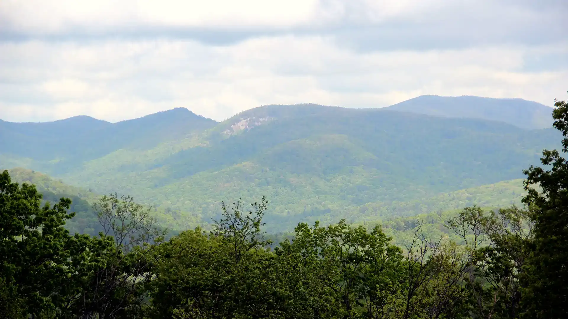
The closest outdoor spots to downtown Dahlonega are Yahoola Creek Park and the trail around Lake Zwerner, both within 1.6 miles of the Square. Within about 10 miles you reach the Appalachian Trail at Woody Gap, trout-stocked Dockery Lake and the Jake and Bull Mountain trails. DeSoto Falls is about 13 miles out, and Amicalola Falls State Park about 15, both measured in a straight line.
Distances on this page are straight-line from the Dahlonega Gold Museum on the Square, so the drive is longer, especially on mountain roads. Each fact links to the agency or business that published it, checked on November 9, 2026.
What waterfalls are near Dahlonega?
Amicalola Falls and DeSoto Falls are the best-known waterfalls near Dahlonega, and both are run by public agencies with published fees and facilities.
- Amicalola Falls State Park, 418 Amicalola Falls State Park Rd, Dawsonville, about 15 miles away. Discover Dahlonega describes a 729-foot cascading waterfall with a walkway and stairs from the base to the top (Discover Dahlonega). The park also has a lodge, cabins, a restaurant and a campground (Amicalola Falls Lodge; Georgia State Parks). Lodge phone (706) 344-1500.
- DeSoto Falls Recreation Area, off US 129 in the Chattahoochee National Forest, about 13 miles away. It sits in the 650-acre DeSoto Falls Scenic Area, with trails to two waterfalls, a campground and trout fishing on Frogtown Creek. Day use is $5 per vehicle (U.S. Forest Service).
- Raven Cliff Falls, reached from the Raven Cliffs trailhead on the Richard B. Russell Scenic Highway near Helen, about 16.5 miles away. The trail follows Dodd Creek to the falls; parking is a $5 amenities fee per vehicle per day, and the lot holds about 30 cars (U.S. Forest Service).
- Dicks Creek Falls, off Mt. Pisgah Church Road north of town, about 10.5 miles away: falls and shoals below the meeting of Dicks and Waters creeks. Discover Dahlonega warns against diving and slippery rocks (Discover Dahlonega).
- Cane Creek Falls, on the private grounds of Glisson Camp & Retreat Center, 2 miles away. It is closed to the public during summer camp (May–July) and whenever a retreat group is on site; from August to April there is limited weekday viewing, 9 a.m.–4:30 p.m., so call (706) 864-6181 first (Glisson).
Where can you hike near Dahlonega?
- Woody Gap, where the Appalachian Trail crosses GA Hwy 60, about 10 miles north. The Forest Service lists mountain views, a restroom and picnic spots (U.S. Forest Service), and Discover Dahlonega names it as a starting point for Preacher’s Rock (Discover Dahlonega).
- Jake and Bull Mountain trails, western Lumpkin County, about 9.7 miles away: roughly 36 miles of connected trails shared by hikers, mountain bikers and horseback riders, reached from two trailheads (U.S. Forest Service). The Forest Service lists the trails as free, while Discover Dahlonega mentions a national forest parking fee, so check before you go (Discover Dahlonega).
- Smithgall Woods State Park, near Helen, about 16.6 miles away, with 28 miles of trails; visitors register at the visitor center, and a parking fee applies (Georgia State Parks).
- Lake Zwerner, 1330 Morrison Moore Pkwy E, 1.6 miles from the Square: a loop trail of about 3.2 miles around the city’s drinking-water reservoir, with a boat ramp, dock and picnic tables. No swimming, wading or gas motors (City of Dahlonega). More close-to-town walks are on our parks and walking trails page.
- Yahoola Creek Park, 1166 Captain McDonald Road, 1.5 miles away: a 1.5-mile walking trail, an 18-hole disc golf course, playgrounds and creekside picnic tables (Discover Dahlonega).
Where can you go tubing, kayaking or canoeing near Dahlonega?
River trips near Dahlonega are seasonal. All three outfitters below are closed or between seasons in winter, so check before you drive out.
- Etowah River Campground, 437 Rider Mill Road, about 4.7 miles away: tube floats on the Etowah River from May through Labor Day, $5 per person when we checked; the campground is open all year. Phone (706) 867-7528 (Etowah River Campground).
- Chestatee River Adventures, 2718 South Chestatee, about 2.4 miles away: sit-on-top kayaks for Chestatee River trips, $29 single and $49 tandem on its site. Phone (770) 540-9950 (Chestatee River Adventures).
- Appalachian Outfitters, 2084 South Chestatee Street, about 1.8 miles away: tubing on the Chestatee and canoe and kayak trips on the Etowah in Dawson Forest, March through October. Phone (706) 864-7117 (Appalachian Outfitters).
Where can you fish near Dahlonega?
- Dockery Lake, about 9.8 miles north: a 6-acre trout-stocked lake with free day use and a Forest Service campground that is closed January 2 through March 31. You need a Georgia fishing license and trout license (U.S. Forest Service).
- Frogtown Creek at DeSoto Falls, with trout fishing in the recreation area (U.S. Forest Service).
- Smithgall Woods, seasonal catch-and-release trout fishing by reservation (Georgia State Parks).
- Frog Hollow Fly Fishing, 900 Frog Hollow Road, a private trout stream plus guided trips; it books by text at (706) 244-4372 (Frog Hollow Fly Fishing).
Where can you go horseback riding near Dahlonega?
- Sunny Farms North, 1332 Longbranch Road, about 3.8 miles away: guided and self-paced trail rides on Saturdays and Sundays, all year. Phone (706) 867-9167 (Discover Dahlonega).
- Dahlonega Carriage & Horse Rides, Forrest Hills Road, about 11 miles away: public and private guided trail rides and carriage rides. Its site lists a public guided trail ride at $55. Phone (706) 867-9395 (Dahlonega Carriage & Horse Rides).
- The Jake and Bull Mountain trails are also open to riders who bring their own horses.
Where can you ride ATVs near Dahlonega?
Iron Mountain Park, 116 Iron Mountain Parkway, about 9.3 miles away, is a privately owned off-road park of about 4,300 acres with more than 200 routes for ATVs, UTVs and side-by-sides, plus camping, cabins and side-by-side rentals (Iron Mountain Park).
What outdoor things can you do for free near Dahlonega?
Yahoola Creek Park, the Lake Zwerner trail and the city parks list no entry fee, and day use at Dockery Lake is free (U.S. Forest Service). The Forest Service page for Woody Gap prints no fee. Plan on a parking fee at state parks, DeSoto Falls and the Raven Cliffs trailhead.
Outdoor listings
Addresses, phones, websites and hours for each place, nearest first. Tap an address for directions.
Wimpy Mill Picnic Area
City picnic area created in 2021 overlooking Yahoola Creek Reservoir, with picnic tables, benches, public parking and an accessible kayak launch.
City Hall Park
Fenced city park beside City Hall with two pavilions, two children's play areas, infant and child swings and a paved walking loop.
Pinetree Recreation Center & Water Park
Lumpkin County recreation center with a double gym, indoor and outdoor pickleball courts and a seasonal water park with slides, lazy river and lap pool.
Yahoola Creek Park Disc Golf Course
Permanent 18-hole disc golf course inside Lumpkin County's Yahoola Creek Park, established in 2012, with holes along the park's creeks and walking trails.
Yahoola Creek Park
Lumpkin County park with a 1.5-mile walking trail, pavilions, ball fields, tennis courts, two playgrounds, an 18-hole disc golf course and creekside picnic tables.
Lake Zwerner (Yahoola Creek Reservoir) Trail
City drinking-water reservoir with a loop trail around the lake (about 3.2 miles, per the city), a boat ramp and dock, picnic tables and fishing where the city allows it. No swimming, wading or gas motors.
Appalachian Outfitters (Dahlonega Outpost)
Seasonal outfitter running short tubing floats on the Chestatee River outside Dahlonega and canoe and kayak trips on the Etowah River in Dawson Forest.
Cane Creek Falls (Camp Glisson)
Waterfall on the private grounds of Glisson Camp & Retreat Center; limited weekday public viewing outside camp season when no retreat group is on site.
Chestatee River Adventures
Seasonal outfitter renting sit-on-top single and tandem kayaks for trips on the Chestatee River south of Dahlonega.
Nicklaus Golf Club at Achasta
Member club with a Jack Nicklaus Signature course along the Chestatee River that also sells green fees to non-members, who must take a cart.
Nicklaus Golf Club at Achasta
Jack Nicklaus Signature 18-hole golf course in the Achasta community along the Chestatee River, which comes into play on over half the holes.
Sunny Farms North
Family-run stable offering guided and self-paced horseback trail rides on weekends year-round, about 1 mile past the north end of GA 400.
Etowah River Campground
Year-round campground on the Etowah River that offers leisurely tube floats on the river from May through Labor Day.
Whissenhunt OHV Trails
Forest Service off-highway-vehicle trail system about six miles north of Dahlonega: 11.2 miles of one-way trail for motorcycles and ATVs under 50 inches wide.
Lumpkin County Park (Lake Lanier boat ramp)
Lumpkin County boat ramp and small recreation area on Lake Lanier, about 8.5 road miles from the square; trailer launching is not possible at low water.
Chestatee Golf Club
Semi-private 18-hole golf course in Dawsonville listed as open for public play.
Chestatee Overlook
Free Forest Service pull-off on GA 60 overlooking the Chestatee River headwaters, the Dockery Lake campground and the Blood Mountain Wilderness.
Iron Mountain Park
Privately owned off-road park with about 4,300 acres and 200-plus routes for ATVs, UTVs and side-by-sides, plus camping, cabins and an on-site grille.
Toto Creek Park
Dawson County park on Lake Lanier with nine primitive campsites, day-use areas, trails, a bathhouse with showers, a courtesy dock and three boat ramps.
Jake and Bull Mountain Trail System
Forest Service network of about 36 miles of connected trails for mountain bikers, horseback riders and hikers in western Lumpkin County, reached from two trailheads.
Dockery Lake Recreation Area
Forest Service campground and day-use area on a 6-acre trout-stocked lake in the Blue Ridge Ranger District north of Dahlonega.
Cooper Gap (Appalachian Trail)
Dirt parking where the Appalachian Trail crosses Cooper Gap above the Army Ranger camp; the AT runs 7.9 miles south from here to Three Forks.
Woody Gap Trailhead (Appalachian Trail)
Forest Service trailhead where the Appalachian Trail crosses GA Hwy 60, with panoramic mountain views, a restroom and picnic spots; a starting point for Preacher's Rock.
Turner Campsites
Private campground near Cleveland offering RV camping and storage, an onsite manager, 24/7 access and trout fishing.
Dicks Creek Falls
Waterfall and shoals just below the confluence of Dicks and Waters creeks in the Chattahoochee National Forest, popular for summer wading.
Preachers Rock (Appalachian Trail from Woody Gap)
Rock outcrop overlook on the Appalachian Trail near Woody Gap, named by Discover Dahlonega as a must-hike stretch with Blue Ridge Mountain views.
Shiners 9 Disc Golf Course at Main Street Park
Permanent 9-hole disc golf course at Main Street Park in Dawsonville, listed in the PDGA course directory.
Dahlonega Carriage & Horse Rides
Stable at Forrest Hills offering public and private guided trail rides, horse-drawn carriage rides and group dinner wagon rides.
DeSoto Falls Recreation Area
Forest Service area in the 650-acre DeSoto Falls Scenic Area with trails to two waterfalls, a campground and trout fishing on Frogtown Creek.
Len Foote Hike Inn
Backcountry lodge in Amicalola Falls State Park reached only by a five-mile hiking trail through the foothills; overnight guests get meals and a bed.
Bolding Mill Campground
Lake Lanier campground and day-use park on Chestatee Road in north Hall County.
Styles Park
Dawson County's 120-acre passive park off GA 183 with about five miles of dirt hiking and biking trails, a half-mile paved accessible loop and restrooms.
Springer Mountain Trailhead
Free Forest Service parking on FS 42; a 0.9-mile hike south reaches the Springer Mountain summit plaque marking the Appalachian Trail's southern terminus.
War Hill Park
Dawson County park on Lake Lanier with 14 primitive campsites, day-use areas, a bathhouse with showers, a courtesy dock, four boat ramps and a pier.
Long Creek Falls (via Three Forks)
Waterfall on Long Creek reached from the Three Forks trail crossing: about one mile on the AT, then a short blue-blazed side trail.
Chattahoochee Golf Course
Public 18-hole golf course in Gainesville, open year-round, with cart rentals.
Mountain Crossings at Neel Gap
Outdoor outfitter where the Appalachian Trail crosses Neel Gap, selling backpacking gear, trail advice and AT souvenirs.
Frank Gross Recreation Area
Eight-site Forest Service campground on Rock Creek past the Chattahoochee Forest National Fish Hatchery, popular for stocked and wild trout fishing.
Byron Herbert Reece Trailhead (Blood Mountain)
Free trailhead where a blue-blazed trail climbs about 400 feet to the Appalachian Trail; Blood Mountain's summit is 1.5 miles beyond the junction.
Amicalola Falls State Park & Lodge
Georgia state park of 829 acres in the Chattahoochee National Forest, home to a 729-foot cascading waterfall with a walkway and stairs from base to top.
Dawson Forest Wildlife Management Area
DNR wildlife management area of 25,500 acres in five tracts with improved roads, marked trails, Amicalola River access, hunting and fishing.
Appalachian Approach Trail
Blue-blazed trail from Amicalola Falls State Park to Springer Mountain and the Appalachian Trail's southern terminus, with several difficult climbs.
Tesnatee Gap (Appalachian Trail)
Dirt parking where the Appalachian Trail crosses the Richard Russell Scenic Highway; the Logan Turnpike Trail also ends here, and Neels Gap is 5.7 AT miles away.
Helton Creek Falls
Free, open-all-year Forest Service trail: an easy 0.2-mile walk with abrupt grade changes to an observation deck at the upper and lower falls.
Sosebee Cove Scenic Area
Free Forest Service scenic area with a short trail through a north-facing hardwood cove known for wildflowers and birds.
Dukes Creek Falls
Day-use Forest Service area on the Russell-Brasstown Scenic Byway with a moderate trail down to decks at the foot of the falls and views toward Mount Yonah.
Vogel State Park
Georgia state park near the Appalachian Trail with 90 campsites and cabins. Lake Trahlyta is drained for dam repairs, so its loop trail and waterfall are closed; other facilities are open. ParkPass required for parking.
Mount Yonah Trailhead
Free Forest Service trailhead off Chambers Road and FS 323 near Cleveland for hikes up Yonah Mountain.
Raven Cliffs Trailhead (Raven Cliff Falls)
Forest Service trailhead on the Richard B. Russell Scenic Highway for the Raven Cliffs Wilderness trail, which follows Dodd Creek to Raven Cliff Falls.
Smithgall Woods State Park
Georgia state park with 28 miles of trails, five first-come picnic shelters and seasonal reservation-only catch-and-release trout fishing; visitors register at the visitor center.
Cooper Creek Recreation Area
Forest Service campground on Cooper Creek with 13 standard sites and a group site, trout fishing in Cooper and Mulky creeks, and short interconnected hiking trails.
Mulky Campground
Forest Service campground on Cooper Creek, a tenth of a mile south of Cooper Creek Campground, with trout fishing and connecting trails.
Atlanta Botanical Garden, Gainesville Garden
Gainesville location of the Atlanta Botanical Garden, with garden areas including a children's garden, stream garden and overlook garden.
Deep Hole Recreation Area
Small Forest Service campground and day-use area on a bend of the Toccoa River, the launch point for the 13.8-mile Toccoa River Canoe Trail.
Don Carter State Park
The only state park on Lake Lanier, where the Chattahoochee River meets the lake, with boat ramps, paddling trails, 44 campsites and 14.5 miles of hiking and horse trails.
Woods at Wessell Disc Golf Course
Permanent 18-hole disc golf course in Gainesville, listed in the PDGA course directory.
Low Gap Campground
Thirteen-site Forest Service campground in the Chattahoochee WMA beside the Mark Trail Wilderness, reservation only, with a vault toilet.
Hardman Farm State Historic Park
State historic park preserving a historic farm and mansion in Sautee Nacoochee, with mansion tours and the Helen to Hardman Heritage Trail.
Unicoi State Park & Lodge
Georgia state park and lodge within the Chattahoochee National Forest, about two miles from Helen, with a lake beach and lodge accommodations.
North Georgia Canopy Tours – Red Hawk Ridge Disc Golf
Privately owned, pay-to-play 18-hole disc golf course at North Georgia Canopy Tours in Lula, listed in the PDGA course directory.
Central Park Disc Golf Course (Cumming)
Permanent 20-hole disc golf course in Forsyth County's Central Park, listed in the PDGA course directory.
Chicopee Woods Golf Course
Golf course in Gainesville with three nines (Village, School and Mill) and online tee times up to 14 days ahead.
UNG Oakwood Disc Golf Course
Permanent 9-hole disc golf course on the University of North Georgia Gainesville campus, listed in the PDGA course directory.
Elachee Nature Science Center
Environmental education center rooted in the 1,440-acre Chicopee Woods Nature Preserve, with hiking trails and set public visitation hours.
Andrews Cove Campground
Seasonal Forest Service campground off GA 75 about 5.5 miles north of Helen; drinking water is no longer available.
Anna Ruby Falls Recreation Area
Forest Service site near Helen with a paved trail from the visitor center to twin waterfalls, picnic sites and the short braille Lion's Eye Trail.
Sawnee Mountain Preserve
Forsyth County preserve protecting over 820 acres of Sawnee Mountain, with a visitor center, interpretive exhibits and about 11 miles of hiking trails.
Toccoa River Sandy Bottoms Recreation Area
Forest Service take-out for the Toccoa River Canoe Trail with campsites, a small-boat ramp, vault toilet, picnic tables and an information kiosk.
Platt Park Disc Golf Course
Permanent 9-hole disc golf course at Platt Park in south Hall County, listed in the PDGA course directory.
Brasstown Bald
Georgia's highest point at 4,784 feet, with a visitor center, observation platform, picnic areas, store, three trailheads and a steep 0.6-mile paved summit trail or shuttle.
North Georgia Technical College Disc Golf Course
Permanent 18-hole disc golf course on the North Georgia Technical College campus, listed in the PDGA course directory.
Morganton Point Recreation Area
The only developed Forest Service campground on Blue Ridge Lake, a 3,290-acre TVA reservoir, with camping, swim beach, picnicking, boating and fishing.
Lake Blue Ridge Recreation Area
Free Forest Service area on the west side of 3,290-acre Blue Ridge Lake for boating, skiing and fishing for bass, bream, catfish, perch and crappie.
Sugar Hill Golf Club
City of Sugar Hill golf course taking tee times one week in advance by phone.
Frog Hollow Fly Fishing
Fly-fishing operation outside Dahlonega with a private trout stream; the guide also runs guided trips on rivers and lakes. Booking by text.
Conner Memorial Garden
City-owned pocket park at North Chestatee and Warwick streets with ornamental and pollinator plantings, benches, a lending library and a water feature.
Dahlonega Gold Mine All-Abilities Playground
Accessible 2,800-square-foot playground in Hancock Park with a mine-shaft climbing structure, Cloud 9 swings, animal sculptures and outdoor musical instruments.
Lumpkin County Park & Community Center
Lumpkin County Parks & Recreation home base next to City Hall Park, with athletic fields, picnic pavilions and a community center with gym and rental rooms.
Boggs Creek Recreation Area
Free Forest Service day-use area on Boggs Creek for picnicking, stream fishing and short hikes; camping, RVs, trailers and OHVs are not allowed.
Waters Creek Day Use Area
Free, no-services Forest Service day-use area along Dicks Creek and Waters Creek inside the Chestatee WMA, near Dicks Creek Falls.
Logan Turnpike Trail
Trail on the historic Logan Turnpike toll road: a scenic first mile along Town Creek, then a steep climb to the Appalachian Trail at Tesnatee Gap.
Appalachian Trail (Georgia section)
The Appalachian Trail's first 76.4 miles run through Georgia from Springer Mountain, crossing Lumpkin County at Woody Gap and climbing over Blood Mountain.
Benton MacKaye Trail (Georgia section)
Primitive backcountry trail starting on Springer Mountain with about 80 miles in Georgia, crossing the Toccoa River on a 260-foot suspension bridge.
Duncan Ridge Trail
Rugged trail along Duncan Ridge through the Cooper Creek WMA from Blood Mountain to the Benton MacKaye Trail in Fannin County, among the area's most difficult.
Thompson Creek Park
Dawson County day-use park on Lake Lanier with trails, restrooms, a covered pavilion, a courtesy dock and three boat ramps.
Nix Bridge Park
Dawson County Lake Lanier park with day-use areas, restrooms, a courtesy dock and one boat ramp.
River Park (Etowah River canoe launch)
Dawson County park with a free canoe and kayak launch on the Etowah River; the downstream take-out at Kelly Bridge charges a small fee.
Lake Winfield Scott Recreation Area
USFS mountain lake recreation area on GA 180; the fishing pier stays open while the campground, beach and pavilion are closed for construction.
Upper Chattahoochee River Campground
USFS riverside campground on the upper Chattahoochee River; temporarily closed for facility improvements.
Listings are compiled from OpenStreetMap, the Dahlonega Downtown Development Authority, Discover Dahlonega and the businesses’ own websites. Walking times and miles are measured in a straight line from the Gold Museum, so the drive is longer. Hours change seasonally, so please confirm with the business before you go. Spot something out of date? Tell us.
Frequently asked questions
How far is Amicalola Falls from Dahlonega?
Amicalola Falls State Park is about 15 miles from downtown Dahlonega in a straight line. The park is at 418 Amicalola Falls State Park Rd in Dawsonville, and the drive is longer than the straight-line distance.
How much does it cost to visit DeSoto Falls?
Day use at the DeSoto Falls Recreation Area is $5 per vehicle per day, according to the U.S. Forest Service, which also sells a $25 Chattahoochee-Oconee annual pass.
Can you go tubing in Dahlonega in the fall or winter?
Usually not. Etowah River Campground runs tubing from May through Labor Day, Appalachian Outfitters runs March through October, and Chestatee River Adventures closes in the off-season.
Where is the Appalachian Trail near Dahlonega?
The Appalachian Trail crosses GA Hwy 60 at Woody Gap, about 10 miles north of the Square in a straight line. The Forest Service trailhead there has a restroom and picnic spots.
What can you do outdoors right in Dahlonega?
Yahoola Creek Park has a 1.5-mile walking trail and an 18-hole disc golf course, and Lake Zwerner has a loop trail, a boat ramp and fishing access. Both are within 1.6 miles of the Square.
More to plan: Dahlonega gold mines and gold panning, wine tasting and vineyards, things to do in Dahlonega and plan your visit.