
Quick answer (TL;DR)
Dahlonega sits in the middle of North Georgia’s fall color cascade. Color starts at the highest peaks and drops roughly 1,000 feet in elevation every week, which is why the best shows usually land in the second half of October up high and hold in the valleys into early November. No official 2026 forecast exists yet; Georgia Forestry Commission Leaf Watch opens October 1. Below: how to read the timing and which drives make the most of it.
Fall color around Dahlonega moves downhill like a slow wave, starting at peaks such as Brasstown Bald and reaching the valleys weeks later. Elevation sets the timing; the official reports trail behind. The higher you drive, the earlier the color. Here is how to plan it.
Every October the same thing happens on the square. The search bars light up with one question: when will the leaves turn this year? Dahlonega, site of the first major U.S. gold rush and the heart of Georgia wine country an hour north of Atlanta, sits in the middle of prime leaf-peeping country. Nobody can circle one weekend on a calendar in September, because the forests do not read calendars. They read elevation.
Dahlonega Leaf Season Runs on Elevation, Not the Calendar
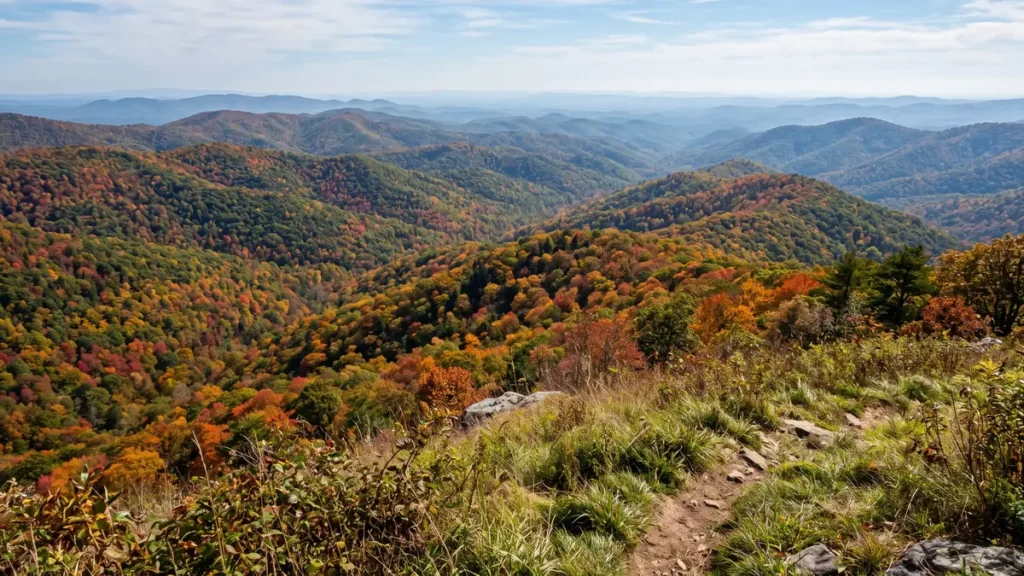
The most useful fact comes from the U.S. Forest Service, manager of the Chattahoochee-Oconee National Forests wrapping this region. Fall color, the agency says, cascades down the mountains, starting at the highest peaks and working into the valleys, with peak color dropping roughly 1,000 feet in elevation every week. That explains why the same weekend can be past peak at Brasstown Bald and just turning in the valleys outside town.
The Georgia Forestry Commission’s reports show the pattern in practice. Its October 16, 2024 report found the most substantial change above 3,500 feet, with the high country at its best over the following 10 to 12 days and ground under 3,000 feet turning outstanding from the last week of October through at least the first weekend of November. A week earlier the commission put it simply: excellent-to-peak viewing in the north Georgia mountains is typically the second half of October. Explore Georgia agrees: mountain parks typically peak in late October, with color from September into much of November.
One caveat before you book: no agency publishes Dahlonega-specific peak dates. Officials speak in elevation bands, not towns. Plan around the shape of the season and check the live sources below.
A typical season, band by band
| Elevation | Typical color window | Where to catch it |
|---|---|---|
| Above roughly 3,500 feet | First to turn; usually best in the second half of October | Brasstown Bald (4,784 feet) via the SR-180 Spur |
| Roughly 2,500 to 3,500 feet | Late October | Vogel State Park (2,500 feet), Lake Winfield Scott (3,260 feet), and the GA-60 corridor, where elevation rises with the miles |
| Lower slopes and valley floors | Final days of October into early November | Around town and the valley floors; watch the weekly reports |
The parks side tells the same story. Black Rock Mountain State Park near Clayton, at 3,640 feet Georgia’s highest state park, is usually among the first to show strong color. Far south, F.D. Roosevelt State Park often waits until early November, more than a week behind the mountains.
What Officials Are Saying About 2026 So Far
As of late September 2026, no official 2026 peak forecast exists. The Georgia Forestry Commission has said Leaf Watch 2026 begins October 1, and until then it is not publishing dated predictions. The commission’s 2026 Leaf Watch story map, published September 2, is live and waiting for reports.
The Georgia State Parks Leaf Watch page is up but pre-season, with a note to come back later for 2026 photos. It currently points to a prediction map from smokymountains.com, a third-party model fine for a general sense of the season but not an official forecast.
The Forest Service’s fall-color page for the Chattahoochee-Oconee, updated August 14, 2026, explains what drives quality rather than naming dates: a drier summer can set up potentially spectacular color across much of the Appalachians, drier soils tend to produce more intense reds, cool September mornings help colors develop, and color keeps longer when October stays clear, dry, and cool.
The Best Leaf Drives You Can Start from the Dahlonega Square
You do not have to drive far to reach the color. State Highway 60 leaves town northbound into the Chattahoochee National Forest, nearly 750,000 acres of mountain woodlands. Two loops off that corridor cover the best of the season: the GA-60 and Suches run, and the Russell-Brasstown byway. Both pair with the full list of things to do in Dahlonega for a bigger weekend.
GA-60 north: Chestatee Overlook, Dockery Lake, and Suches
Start with the overlook. The Forest Service’s directions run 11.7 miles north on State Highway 60, with the Chestatee Overlook on the right just past the Dockery Lake Campground entrance. It frames the watershed that feeds the Chestatee River, Dockery Lake in the foreground, the Blood Mountain Wilderness on the horizon, and the agency calls it a great photo opportunity.
Dockery Lake sits about 26 miles north on GA-60 via Forest Service Road 69, 11 campsites near the water. The Forest Service describes October there without hedging: the trees put on a show, dark greens giving way to reds, oranges, and yellows, and thousands making the yearly trek. Stay on GA-60 and you land in Suches, “the valley above the clouds” in Explore Georgia’s words. The state’s official Helen-to-Dahlonega fall road trip finishes along this corridor, following Highway 60 from Suches back into town.
Wolf Pen Gap Road and Lake Winfield Scott
From Suches, or from US-19/129 near Vogel, State Route 180 is the stretch both state agencies single out. The Forestry Commission’s October 2024 report recommended Wolfpen Gap Road by name: SR-180 from US-129/19 near Vogel State Park to SR-60 in Suches, passing Lake Winfield Scott, one of Georgia’s highest-elevation lakes. Explore Georgia calls the 12-mile stretch golden leaves and rolling hills, with the lake perched at 3,260 feet.
One caution specific to 2026: Georgia State Parks warns that a new visitor center is under construction at Vogel and parking may be very limited this season. Vogel sits at 2,500 feet at the base of Blood Mountain, the highest summit on the Appalachian Trail in Georgia. Arrive early or let the road do the work.
The Russell-Brasstown National Scenic Byway
The only road in the area with a formal National Scenic Byway designation, the Russell-Brasstown loop runs about 40 miles over State Highways 348, 180, and 17/75. The Forest Service suggests allowing at least three hours, the Federal Highway Administration confirms no fee is required, and the loop circles the headwaters of the Chattahoochee River.
The marquee stop is Brasstown Bald, at 4,784 feet the highest point in Georgia. On a clear day the observation deck covers a 360-degree span the Forest Service says can reach four states, and the summit webcams make it a practical morning-of check. Entry and the shuttle run $8, or take the half-mile Summit Trail on foot. Waterfall options near the loop: Helton Creek Falls, a walk of less than a mile to a double fall the Forest Service recommends for high-elevation color; Dukes Creek Falls at 2.2 miles round trip; Anna Ruby Falls via a 0.4-mile paved path to 150-foot twin falls; Raven Cliff Falls at 5 miles. Helen’s Bavarian downtown sits just off the byway for lunch.
From Dahlonega, the standard approach is GA-60 north to US-19 toward Helen, where the byway’s Richard B. Russell Parkway leg begins, the routing the state’s official fall itinerary uses in reverse. GA-60 and Wolf Pen Gap Road themselves carry no byway designation; they show up in Forest Service directions and state itineraries as recommended routes, which in October counts for just as much.
A Leaf-Peeping Weekend Built Around the Color
Saturday, go high first. Check the Brasstown Bald webcams and the day’s color report at breakfast, then drive the byway loop with Brasstown Bald and whichever waterfall crowds allow. Come back down US-19 and GA-60 into town for the evening. Our full weekend in Dahlonega itinerary covers the pacing and the food.
Sunday, stay closer to town on the GA-60 corridor: Chestatee Overlook first while the light is still raking, Dockery Lake if the campground loop is quiet, then Suches and Wolf Pen Gap Road. If the high country is socked in, flip the days. The Forestry Commission warns it is not uncommon for the piedmont to be clear while fog hides the higher views.
October weekends bring crowds. The Gold Rush Days festival guide explains the weekend the square is packed shoulder to shoulder. Read up on parking in downtown Dahlonega before you go. For everything else that pairs with the color, our Dahlonega in the fall guide picks up the restaurants and the tasting rooms.
Hikes That Earn Their Views
The big summit is Blood Mountain. From the Byron Herbert Reece trailhead on US-19/129 north of Neels Gap, reach the Appalachian Trail and continue about 1.5 miles to the top, which the Appalachian Trail Conservancy lists at 4,461 feet, the highest point on the A.T. in Georgia. Fair warning from the Forest Service: this is the trail’s most heavily used portion in Georgia and parking is limited, so an early start is not optional on a peak-color Saturday. Quieter alternatives include Slaughter Creek, Jarrard Gap, and Coosa Backcountry.
Closer to Suches, Explore Georgia points to Sea Creek Falls, Sosebee Cove, and Preachers Rock, a two-mile Appalachian Trail walk to a rocky outcrop with 360-degree views. For late season, the 1.6-mile Laurel Ridge loop at Smithgall Woods climbs to a Mount Yonah view the state says opens up once most leaves are off. Amicalola Falls State Park northeast of Dawsonville pairs a spot on the state parks’ top-ten fall-color list with a 729-foot cascade its lodge calls the third-highest cascading waterfall east of the Mississippi. Check current Forest Service advisories before any hike.
Frequently Asked Questions
When is leaf season in Dahlonega in 2026?
No official 2026 dates exist yet. The Georgia Forestry Commission starts Leaf Watch 2026 on October 1, and until then nobody can honestly name a peak weekend. Typically, the second half of October is strongest at high elevations, with late October into early November better lower down.
When do leaves usually peak in the North Georgia mountains?
Typically the second half of October. The Georgia Forestry Commission describes excellent-to-peak conditions in the north Georgia mountains as typically the second half of October, and Explore Georgia says the mountain parks usually peak in late October. The highest ground turns first and the valleys follow, sometimes holding into the first week of November.
How does elevation affect fall color timing around Dahlonega?
The U.S. Forest Service says peak color drops about 1,000 feet in elevation every week, cascading from the highest peaks into the valleys. Brasstown Bald, at 4,784 feet, turns first; Vogel State Park and Lake Winfield Scott follow; the lowest valleys come last, often in early November.
Where can I check current fall color reports for Georgia?
Start with the Georgia Forestry Commission’s Leaf Watch, which begins publishing 2026 reports on October 1. Georgia State Parks keeps a Leaf Watch page that fills in with photos and updates as the season develops, and the Forest Service maintains seasonal notes for the Chattahoochee-Oconee. The Brasstown Bald webcams show the highest terrain live. The smokymountains.com map is third-party, not an official forecast.
Will fall color be good in Georgia in 2026?
Too early for an official verdict. The Forest Service’s season notes, updated August 2026, explain what drives quality: a drier summer can set up more intense reds, cool September mornings help color develop, and a clear, dry, cool October helps it last. Mechanics, not a forecast, so watch the reports once they begin.
What is the best scenic drive from downtown Dahlonega for fall color?
Head north on State Highway 60. The Chestatee Overlook arrives 11.7 miles from town per the Forest Service’s directions, with Dockery Lake below and the Blood Mountain Wilderness beyond. Continue to Suches and loop back over Wolf Pen Gap Road past Lake Winfield Scott, corridors the state itself recommends.
How long does the Russell-Brasstown Scenic Byway take?
Plan on at least three hours, not counting stops. The loop runs about 40 miles over State Highways 348, 180, and 17/75, with no fee to drive it. Brasstown Bald charges $8 for entry and the shuttle.
Is Brasstown Bald worth visiting during leaf season?
Yes, when the weather cooperates. At 4,784 feet it is Georgia’s highest point, and the observation deck takes in a 360-degree view the Forest Service says can reach four states. Check the webcams first: the Forestry Commission warns that fog can hide the high-elevation views while the piedmont stays clear.
Is Vogel State Park open during fall 2026?
The park is open, but Georgia State Parks warns that a new visitor center is under construction and parking may be very limited this season. Vogel sits at 2,500 feet at the base of Blood Mountain, and the roads around it, especially Wolf Pen Gap Road, draw leaf peepers all October. Arrive early.
Is GA-60 a designated scenic byway?
No. The only designated National Scenic Byway in the area is the Russell-Brasstown loop. GA-60, Wolf Pen Gap Road, and the Suches corridor appear in Forest Service directions, Forestry Commission suggestions, and Explore Georgia itineraries as recommended drives, but carry no byway designation. In October the difference matters little.
Can you still enjoy a leaf-season trip in November?
Yes. Valley color often holds into the first week of November; in 2025 the Georgia Forestry Commission reported northwest Georgia at peak that late. Once the leaves drop, views open up. State parks recommends the 1.6-mile Laurel Ridge loop at Smithgall Woods for its Mount Yonah view after most leaves are off.
What should I know about driving mountain roads during leaf season?
Fog is the big one. The Forestry Commission notes it is common for the piedmont to be clear while the higher elevations sit in fog that hides the views. Crowds are the other: the Forest Service says thousands make the yearly trek to Dockery Lake, and parking at its Byron Reece trailhead is limited on the most heavily used portion of the Appalachian Trail in Georgia. Traffic on two-lane roads like Wolf Pen Gap Road moves at leaf-peeping speed.
If the color keeps pulling you back until you want a place of your own in these mountains, the local experts can help: Get local guidance on Dahlonega real estate from Gold Peach Realty or call (770) 283-1223.